|
The Vitals
|
 |
Great
selection of climbs from 5.7-5.13
|
 |
Difficult to find
|
Locals Tips
Head to the potholes afterward for a
great swim.
Dogs?
Yes
Links
No other info available
The Routes
The Schnozz (5.8)
Ear No Evil (5.9)
Evil Variation (5.11a)
Marshmallow Crack (5.8)
A Chickaree's Tale (5.11)
3rd Degree Burn (5.12b)
Dragon's Back (5.11)
Camelback (5.11)
French Tickler (5.7)
Old Camp Dihedral (5.7)
Meat Lover Crack (5.10b)
Fiddler (5.11a)
The Green Alien (5.11c)
Tulip (5.10c)
The Connector (5.10a)
Bluff Diagonal (5.11)
Parralax Right (5.9)
Parallax Buttress (5.10d)
Edges and Ledges (5.8)
Original Route (5.11)
Widowmaker (5.10a)
Undertaker (5.10b)
|
|
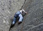
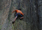
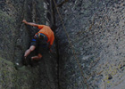
Old Camp Bluff
Old Camp Bluff is an ideal
climbing area for those hot summer days or any time you want to beat
the crowds. The price for this is a long drive from Tahoe and then a
bushwhack to where you hope it is. Having been ther several times, it's
still a roll of the dice as to whether I'll hike right to it, or end up
below it with a scramble back up. North-Northwest facing, and around
7,600' in an area that receives a lot of snow, it can be late June
before the entire area is ready for climbing. There are anchors on top
of just about very climb and topropes are easy to set up. The quality
of the granite is generally very good although the further west along
the wall you go the more it is decomposed. The climbs are generally
35'-70'
with
a couple slightly higher so even a fifty meter
rope will usually do the trick.
Old Camp Bluff Pictures
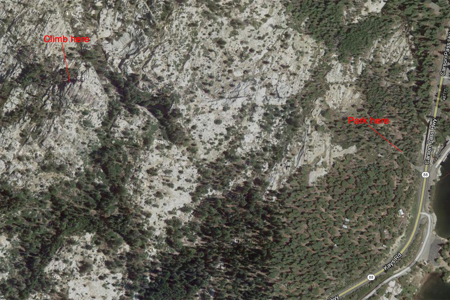
Directions
- From South Lake Tahoe drive to and past Kirkwood on Hwy 88. After
crossing the Silver Lake outlet take the first right and head up until
it ends. Head almost due west (just North of) for a little
over a
half mile. It's somewhat difficult to find until you pass it, at which
point it is more obvious as the highest point. EDIT- The gate now seems
to be permanently closed. Walk up the gated road. Once you pass a
downed gazebo like structure turn right up a dirt road. Then pass the
shiny water tower on it's right and follow the well marked cairn trail..
|