Tahoe Beaches
Tahoe Videos
Tahoe Events
Ski Resorts
Weddings
Disc Golf
Camping
Climbing
Hiking
Biking
Golf
Gear
Fishing
Rafting
Kids Play
Tahoe Images
Tahoe Weather
Advertise Here
Home Page
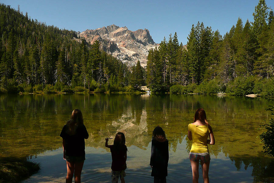
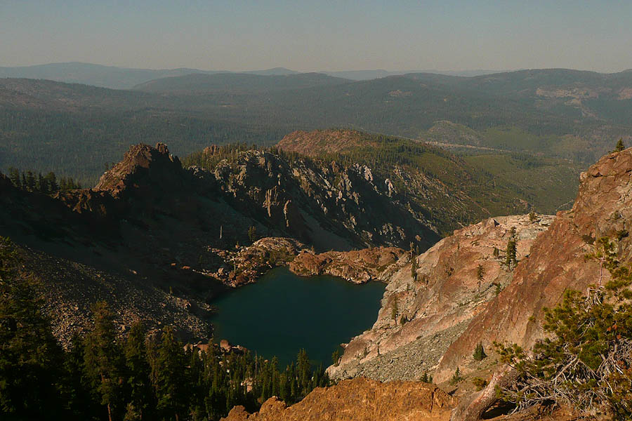
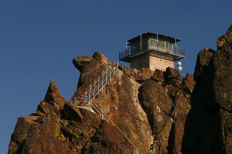
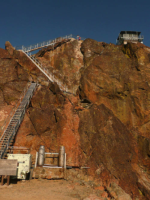
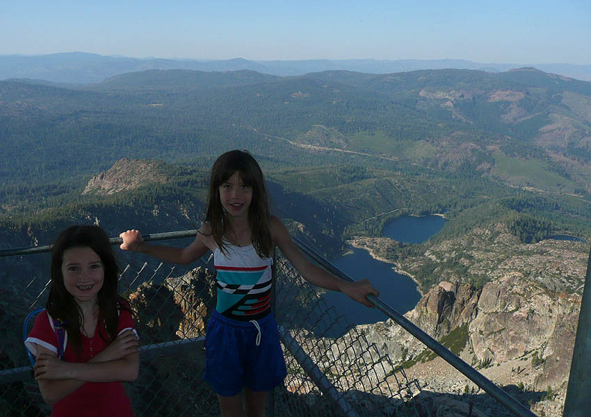
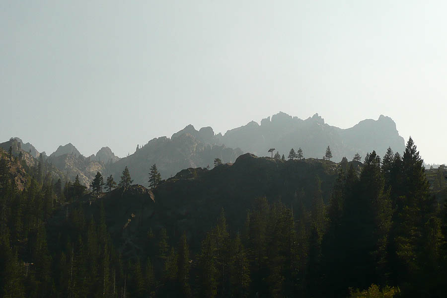
Sierra ButtesThe Sierra Buttes stand tall above everything else in
the lakes basin. Numerous spires provide dramatic views from almost
every direction. There are a number of ways to reach the peak, on which
fire watch tower sits uncomfortably. You can actually get pretty close
with a strong 4x4 with good clearance. By far the better and more
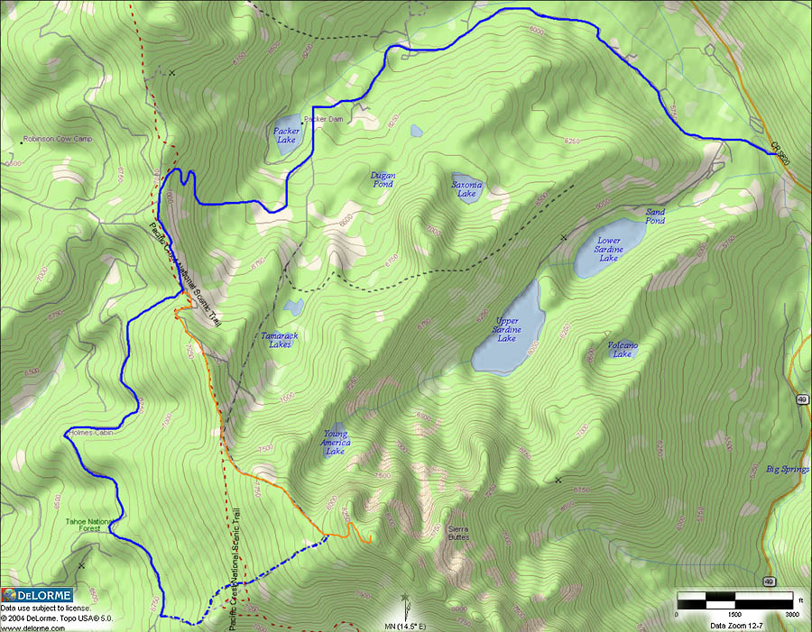
scenic route(s) start from different trailheads, the Sardine Lake,
Tamarack lakes, and Packer Saddle Trailheads (start of the Downieville
downhill). The 4x4 trail leaves the Packer Saddle Trailhead and then
loses elevation on the Butcher Ranch Rd, which continues past the
turnoff/pseudo trailhead all the way to Sierra City. The Sardine Lake
Trailhead leads you to the Tamarack Lakes trail, which eventually
connects with the trail from Packer Saddle (Packer Saddle Trailhead is
used for the Mountain Facts). The trails
are all well used and not particularly difficult, but there are some
steep stairs at the very end which seem to scare some people more than
others. the area is also very popular as backcountry ski destination
and I will be back soon to verify it. It IS on the To Do List.
related links |
|
|